This clip gives an idea of the Pripyet marsh and why it can be so tough fight in.
We received the 1st map proofs from our printer yesterday and after some very positive conversation with him this morning, we will receive a second corrected set of proofs in a couple of days. The maps look great!
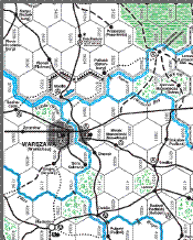
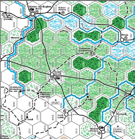
Due to the many requests, we will include map clips from the main front border areas, starting with the lines east of Warsaw.
The printer assured us that the map proofs will go in the mail tomorrow and should be here Monday the 16th. As soon as we get them reviewed, signed and back, we’ll get a slot for printing.

We will continue to show clips of Total War components until the games go out the door. This clip covers a critical part of eastern Prussia at the start of Barbarossa.
We have spoken a number of times with the printer last week and they will be sending the map proof copies as soon as possible.
While we are waiting for the printers to give us a printing slot, we will continue to show you clips of the artwork that is at the printers. This is the final Master Terrain Key for Total War. Arthur Goodwin will be answering some of your questions about terrain and the maps in the next few days on the Europa Association list. For those of you have not signed up for the list, it is a free discussion group on the Europa series of games. Check out EuropaAssociation@yahoogroups.com.
We expect the printers to get back with us this week on the printing for Total War.
The Total War maps have been sent to the printers and once they send us back proof copies of those maps, they will receive approval to print the counters and maps. We will let you know as soon as we receive the proof copies for review and the printing and delivery schedule back to us.
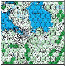
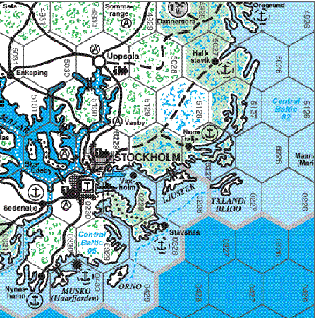
And a Baltic region sample:
The first map clip from the Baltic region is part of two full size maps. This was taken from the draft layout which kept the two maps together to finalize both. You can see both of the key ports of Turku and Soviet occupied Hango. The islands of Saaremoa and Hiiumaa were to be a feature of the Soviet defense of the Baltic coast. The second clip is the completely redone area around Stockholm. Compare it with previous map versions of this area.