The Total War maps have been sent to the printers and once they send us back proof copies of those maps, they will receive approval to print the counters and maps. We will let you know as soon as we receive the proof copies for review and the printing and delivery schedule back to us.
And a Baltic region sample:
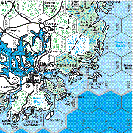
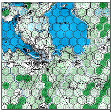
The first map clip from the Baltic region is part of two full size maps. This was taken from the draft layout which kept the two maps together to finalize both. You can see both of the key ports of Turku and Soviet occupied Hango. The islands of Saaremoa and Hiiumaa were to be a feature of the Soviet defense of the Baltic coast. The second clip is the completely redone area around Stockholm. Compare it with previous map versions of this area.

Nice samples but the links to the new clips are the wrong way around!
Oops! Fixed it this morning, thanks for pointing that out Ralph.
Oh boy! oh boy! it’s getting closer!
I am looking forward to sale.
from JAPAN