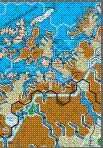
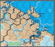
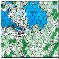
The map clip covers a critical part of Finland and the northern approaches to Leningrad. Gamers will note the presence of the Salpa defensive line. Built by the Finns after the conclusion of the Winter War and the destruction of the Mannerheim fortifications, it was the last hope of stopping a Soviet drive on Helsinki. In 1944, the line became part of the reason the Soviets called off their offensive in Finland. Memories of the massive casualties in breaching the Mannerheim line were still vivid.
We are much closer to having a publishing schedule for Total War. The last of the redone maps will be finished and reviewed by Monday, March 14th. We will send these files to the printer the same day. The printer usually takes about 4 days to print and express mail proof copies for our approval. We will need two days to proof the maps and send them back. Once the printer receives the approved maps, they will give us a slot when they can complete the printing. All of the printing there will be done in the same slot and includes sixteen counter sheets, box tops and bottoms and the eight maps. While this is entirely up to the printers, in the past it has usually been 4 to 6 weeks. We will let you know as soon as we are given the slot.
Warspite in the fjord!
Moving west from Kandalaksha to the other side of the Scandinavian peninsula. Royal Navy destroyers and then the battleship HMS Warspite entered Narvik’s Ofotfjord in April 1940 and smashed the German destroyers that had carried the Gebirgsjaeger mountain troops to the small but vital port. Warspite’s entry into the narrow fjord was not as reckless as it might seem. Her catapult launched Swordfish warned the RN ships of the German positions after sinking a waiting U-boat. ‘Never has a warship been better served by her aircraft’, was a well deserved by the awkward looking biplane and its crew.
Click on the map to see a larger view.
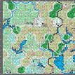
On the Road to Kandalaksha.
Things have changed a bit from the first maps seen in A Winter War and Fire in the East. The terrain here, like that further north near Murmansk is much more accurate for the period and will require more thought for an offensive to do more than retake Salla. Your going to have to do better than Nord If you want to make the journey to Kandalaksha.
Click on the map to see a larger view.
And you thought it was going to be a real push to get to Murmansk! The terrain will present some awesome challenges for the attacker. Not the least of these will be keeping troops in supply. Something to think about.
The fifth map should be done on Monday. We will send a clip this next week.
Click on the map to see a larger view.
How often have you taken Murmansk and then looked across the White Sea at the last big port in the north – Archangel (or Arkhangelsk as the natives would say)? The terrain is dense and trackless, wet, cold and a long way away. Rather like Minnesota (with apologies to everyone in that beautiful state). Dig out your copy of Fire in the East and compare the difference between the maps. A lot of research went into all of these maps but the difference here is more than striking.
We still have about one and a half maps to lay out. Next week, Murmansk.
Click on the map to see a larger view.


